What to decide before ordering image detection AI, and why performance is hard to guarantee in a contract
Before ordering detection AI, decide four things: what to find, where images are taken and the model runs, how results are used, and how many misses and false detections are acceptable. How to set up evaluation, staged contracts, and how to check whether YOLO can be used commercially.
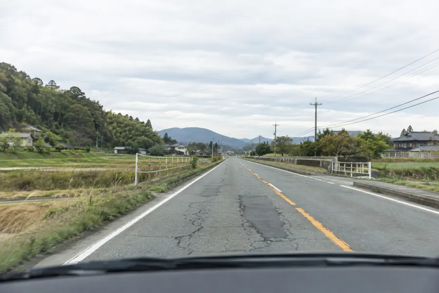
There are four things to decide before ordering. What to find, where the images are taken and where the model runs, who uses the results and how, and how many misses and false detections are acceptable. How training photos are collected and how the model is evaluated both follow from these four. The type of model and the number of photos come after.
How would you decide them for road damage?
| What to decide | Example for road damage | What happens if you don't |
|---|---|---|
| Target | Only potholes, or cracks too? From what size? | The rules for annotation (drawing ground-truth boxes) vary from person to person |
| Setting | Shot on a smartphone, a dashcam or a dedicated vehicle? Where does it run? | Training photos and field photos don't match |
| Use | Does staff check each candidate one by one, or are they totted up as counts? | It's unclear which evaluation numbers to look at |
| Acceptable errors | Reduce misses, or reduce false detections? | There's no standard for calling it finished |
Put the target into words, including size and severity, not just its name. Whether you want to know where holes are, or to diagnose the degree of pavement deterioration section by section, changes what gets built. The crack ratio (%) used in pavement diagnosis, for example, can't be produced by a detection model that just draws boxes on photos (for the indicators, see the summary of Japan's Pavement Inspection Guidelines).
Misses or false detections: which should you reduce?
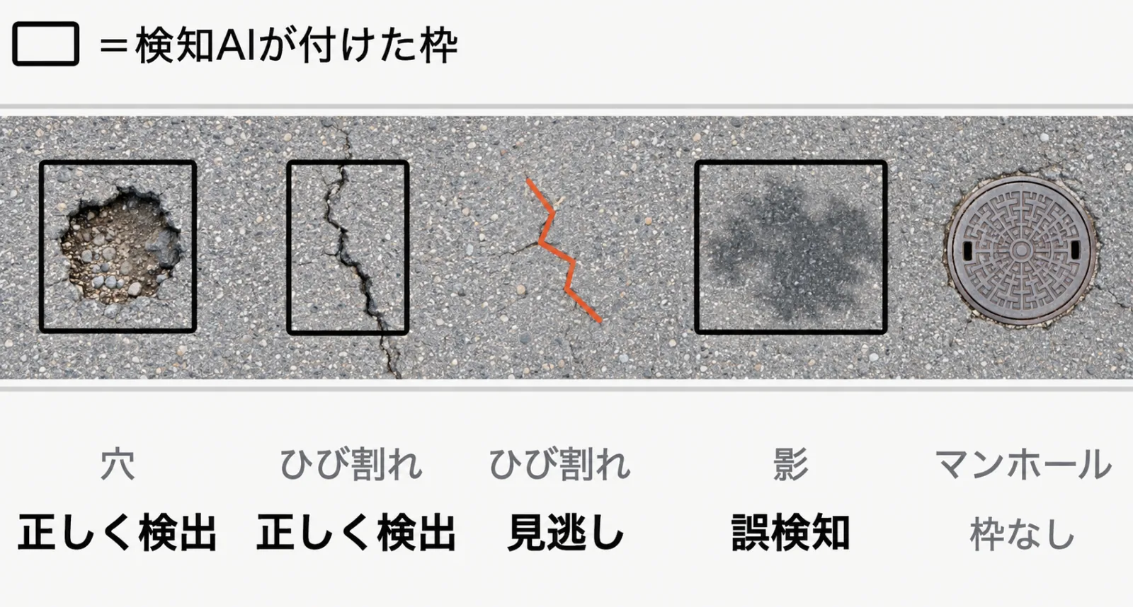
A miss is failing to detect damage that's really there. A false detection is detecting something that isn't damage, such as a shadow or a stain. In evaluation, each is expressed with these metrics (Source: Ultralytics Docs).
| Metric | Share of what | When high |
|---|---|---|
| Precision | Results reported as "found" that were correct | Few false detections |
| Recall | Real objects that were detected | Few misses |
Detection AI gives each candidate a score (confidence) and keeps only those above a threshold. Raising the threshold reduces false detections, but if a discarded candidate was real damage, it becomes a miss.
Which to reduce depends on the use. If staff check every candidate by eye, you can lean towards fewer misses even at the cost of more false detections. If results are used as counts without anyone checking, both misses and false detections throw the numbers off. Potholes are damage that Japan's Pavement Inspection Guidelines say should be "dealt with as soon as found", so if they are a target, weigh misses heavily (Source: Pavement Inspection Guidelines, p. 3).
How many training photos do you need?
The number needed depends on the target and the shooting conditions, so it can't be fixed in advance, because performance on photos taken under different conditions from training isn't guaranteed. METI's contract guidelines (AI section) also say that model performance depends on the training data and behaviour on unseen inputs is unclear, so guaranteeing performance at the time of contract is difficult (Source: METI).
So first list the range of photos that will be taken in the field, try it small, and add photos for the conditions that are missing.
- Camera equipment and mounting (smartphone, dashcam, dedicated vehicle)
- Driving speed, time of day, weather, season
- Road condition (new pavement, old pavement, repair patches)
- Things that look like damage (shadows, stains, puddles, white lines, manholes)
You can also try the public RDD2022 dataset (47,420 road images from six countries including Japan, covering three types of crack and potholes), but in the end confirm on photos from your own site (Source: Arya et al., arXiv:2209.08538).
How do you decide the evaluation?
Evaluate on photos not used in training. Split off the evaluation photos before training starts, and take them on different days and routes from the training photos. Mixing frames cut from the same video into both makes evaluation numbers look better than they are. The ordering side, who know the site best, should take the lead in choosing evaluation photos.
Match the counting to the units of the work, too: decide in advance whether to count by damage size, and how many metres off a position can be and still count as the same damage. MLIT's catalogue of inspection support technologies, for example, splits potholes into under 10 cm, 10 to 20 cm and 20 cm or more, and judges whether each was shown within 5 m of its true position (Source: MLIT).
The mAP figure often seen in papers gives a rough sense of performance. What the work needs to know is how many misses and false detections there were at the chosen threshold. Ask for photos of missed examples and false detections to be included in the report.
How should the contract be split?
METI's guidelines describe an "exploratory, staged" development approach in four stages: assessment, PoC (proof of concept with a prototype), development, and additional training. Since you decide whether to continue after seeing each stage's results, you can stop as soon as it's clear performance won't be good enough.
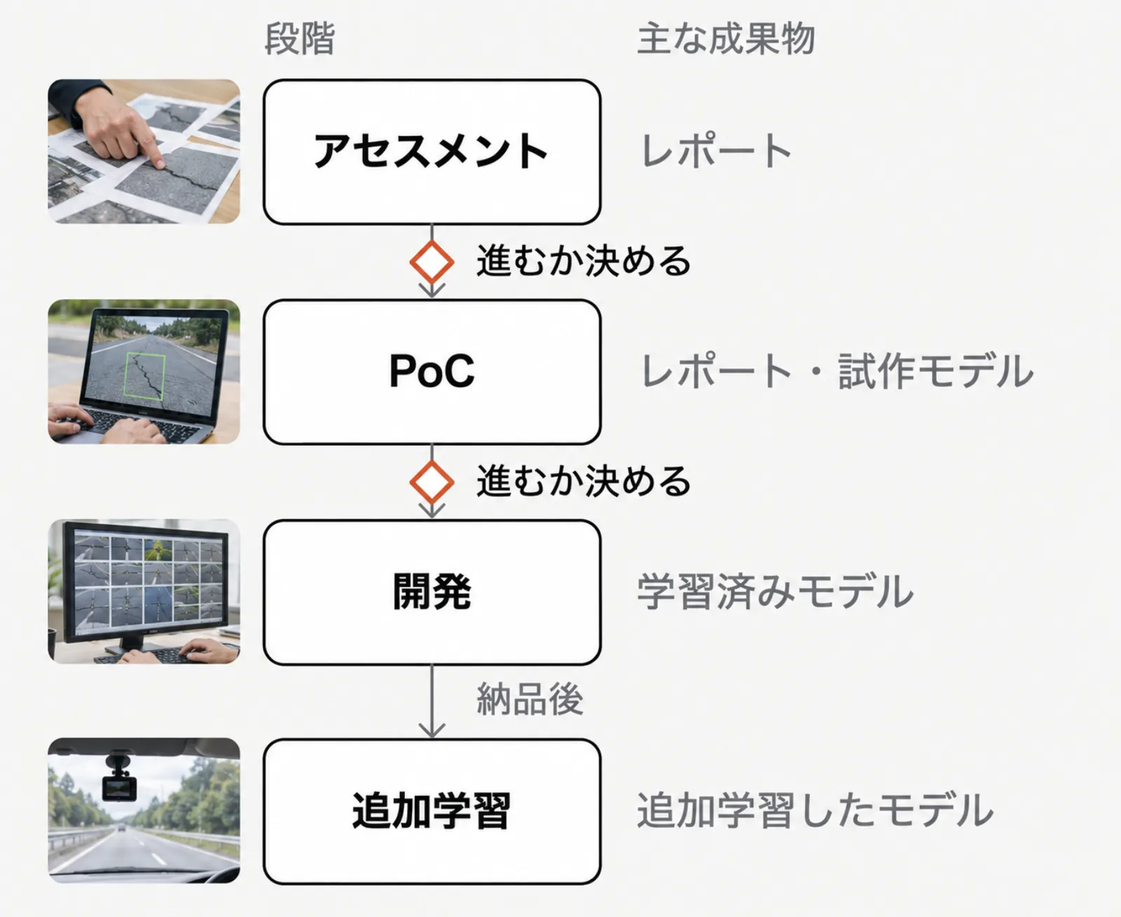
Dividing cost and time by stage also makes the burden easier to foresee for the ordering side. What most affects the price is the variety and difficulty of the targets, the range of shooting conditions and the amount of annotation.
Also decide before ordering whether additional training after delivery goes into the contract. Once in use, photos from conditions no one anticipated will turn up. Discuss who will review the model, how often, and with which photos. Issues of contract form and rights to deliverables can be checked in METI's "Contract checklist for using and developing AI" (Source: METI).
Can YOLO be used commercially?
You can't say across the board that "YOLO can be used commercially" or "can't". Detection models named YOLO come from more than one provider, and the terms differ by provider. When building on a published model, check the terms of the code, the trained weights and the training data separately. These are the terms shown on the providers' pages as checked on September 27, 2026.
| Name | Code | Weights | Training data |
|---|---|---|---|
| Ultralytics YOLO | AGPL-3.0, or a paid Enterprise License | Models you train are also covered by AGPL-3.0 by default | No statement found |
| YOLOX | Apache License 2.0 | No statement found | No statement found |
| RF-DETR | Core under Apache License 2.0; Plus components under PML 1.0 | Mostly Apache License 2.0; detection XL and 2XL under PML 1.0 | No statement found |
| RDD2022 (dataset) | LICENSE file is MIT | Not applicable | Images: CC BY-SA 4.0 in the README, CC BY 4.0 on figshare; the wording differs by source |
(Sources: Ultralytics License, YOLOX LICENSE, rf-detr, RoadDamageDetector, figshare)
According to Ultralytics, using YOLO's code or models trained with it requires either publishing your whole project under AGPL-3.0 or obtaining an Enterprise License. This applies even if you train from scratch or use it only internally.
When ordering, ask for a list of the code, weights and data used, with names, versions, licenses and the date checked. Also ask, before signing, who is responsible for meeting which terms.
What to prepare for a consultation
You don't need perfect documents. If the following are known, things move faster.
- What you want found, with example photos (clear ones, borderline ones, and look-alikes that aren't targets)
- Camera equipment, how photos are taken, and where it will run (smartphone, field device, cloud)
- Who checks the results, how, and what they're used for
- Photos you can set aside for evaluation, and people who can judge the ground truth
- Rights to the photos, how faces and number plates in shot are handled, and whether the data you hand over may be used for anything besides development
The information on contracts and licenses is not legal advice. Check the original text before use, and if in doubt, ask the provider or a professional such as a lawyer.
If you'd like to discuss building detection AI Infra Intelligence builds apps with AI models built in, matched to what you need to find. From sorting out requirements to training, evaluation and retraining in operation, the work starts small and grows from there.
Last checked: September 27, 2026
References
- MLIT Road Bureau: Pavement Inspection Guidelines, October 2016 (Japanese)
- MLIT Road Bureau: Performance catalogue of inspection support technologies (pavement and road patrol), March 2026 (Japanese, PDF, about 160 MB) (listed on MLIT: Use of new road technologies)
- METI: Contract Guidelines on Utilization of AI and Data, version 1.1 (December 2019), AI section (June 2018) (Japanese)
- METI: Contract checklist for using and developing AI, February 2025 (Japanese)
- Ultralytics Docs: YOLO Performance Metrics
- Ultralytics: Ultralytics License
- Megvii-BaseDetection/YOLOX: LICENSE (GitHub)
- roboflow/rf-detr (GitHub)
- Arya et al.: RDD2022: A multi-national image dataset for automatic Road Damage Detection, arXiv:2209.08538
- sekilab/RoadDamageDetector (GitHub)
- figshare: RDD2022 - The multi-national Road Damage Dataset released through CRDDC'2022